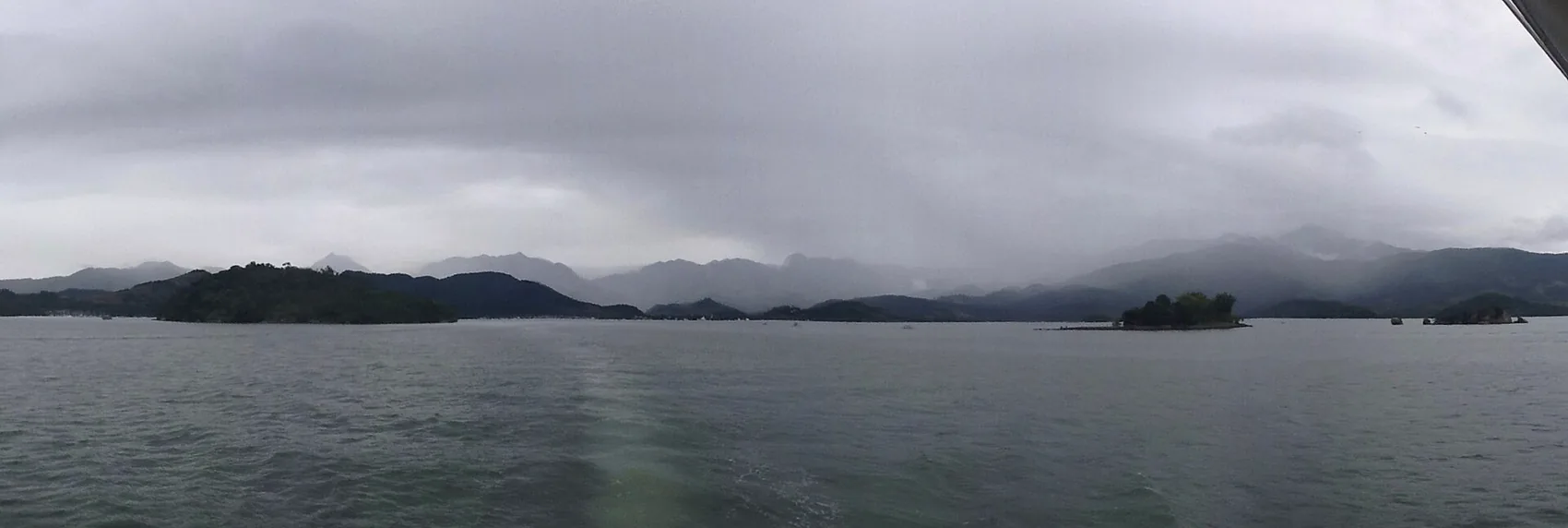
Saco do Mamanguá is an eight-kilometre arm of quiet green water reaching into the mountains south of Paraty — often called a tropical fjord, home to caiçara fishing families, mangrove, and one very steep peak. Here is how to visit it well.
Look south from the deck at Chalé Bel Air and the water in front of you does something unusual. Instead of running out flat to the horizon, one long finger of green sea reaches back into the mountains and disappears between two ridges of forest. That inlet is Saco do Mamanguá, and it is the reason a lot of people who think they have seen the Costa Verde come back and admit they had not. It is quiet in a way the open bay never quite is, and it rewards the small effort it takes to reach it.
Guidebooks like to call Saco do Mamanguá "the only tropical fjord in Brazil," and that phrase does the job of telling you what to expect: a narrow arm of the sea, roughly eight kilometres deep, walled by steep rainforest hills, calm as a lake for most of its length. The label is not quite right in the geological sense, which we will get to, but the feeling is exactly right. You paddle or motor inland and the swell dies, the birds get louder, the mangrove closes in, and a fishing culture that has lived here for generations goes about its day around you.
This guide is the version we give our own guests: what the place actually is, how to get there from Paraty without wasting a morning, what kayaking and the Pico do Mamanguá climb really involve, who lives there and how to visit them well, and how to fold the whole thing into a stay on the hillside. No hype, just the honest shape of a very good day.
What Saco do Mamanguá actually is
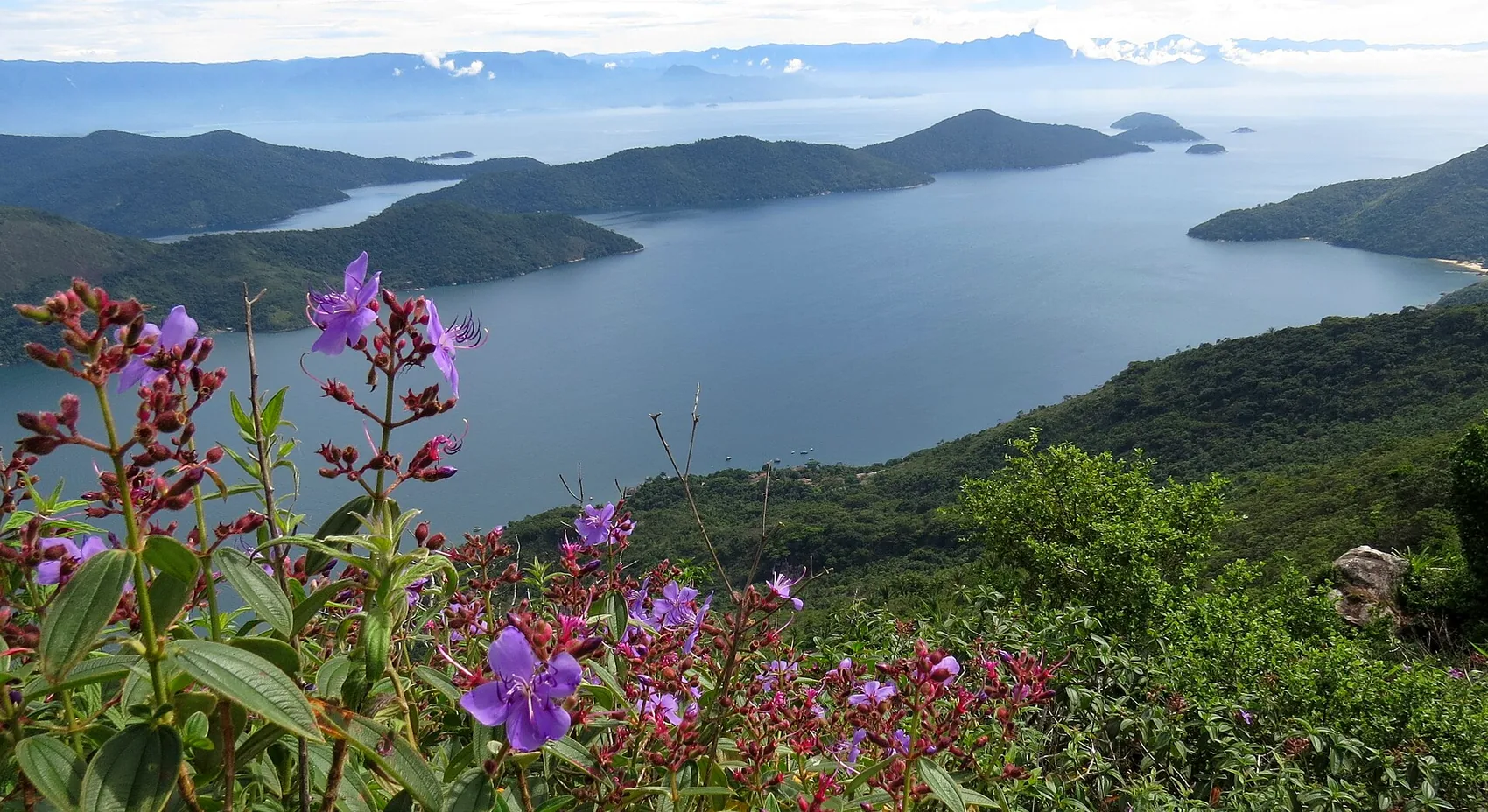
Saco do Mamanguá is a sea inlet on the Juatinga peninsula, the long tongue of protected land that closes off the southern side of Ilha Grande Bay. It runs about eight kilometres from its mouth to its innermost beaches, is at most two kilometres wide, and rarely deeper than about ten metres. Along that length it holds dozens of small beaches and coves, a broad mangrove at its shallow head, and a handful of caiçara communities that between them number a few hundred people. The whole thing sits inside a federal conservation area, the Área de Proteção Ambiental de Cairuçu, which is a large part of why it still looks the way it does.
The "tropical fjord" tag deserves a footnote, because getting it right is part of understanding the place. A true fjord is carved by a glacier grinding a valley below sea level, then flooded when the ice retreats — think Norway or New Zealand. Mamanguá was shaped by a river valley that drowned as sea levels rose after the last ice age. The technical word for that is a ria, not a fjord. Same dramatic silhouette, different sculptor. We mention it not to be pedantic but because it explains the mangrove and the gentle, muddy, life-filled head of the inlet — features you would never find at the foot of a glacier.
What it means for you as a visitor is a body of water that behaves like a sheltered lagoon. The mountains block the wind, the mouth is narrow enough to knock down any real swell, and the far end is shallow and warm. That combination is rare on an otherwise open coast, and it is the practical reason Mamanguá is such forgiving water for a first-time kayaker or a family with children.
The name itself is caiçara, from the older Indigenous languages of the coast, and like a lot of local place-names its exact meaning is argued over — commonly translated as something close to "many islands" or tied to the mangrove and the crabs that live in it. That uncertainty is fitting for a place whose whole appeal is that it was never tidied up and labelled for tourists. It was a working stretch of coast for centuries before anyone thought to call it a fjord, and it still is.
Where it sits, and how it fits your trip
On the map, Saco do Mamanguá lies south of Paraty town, tucked behind the Juatinga peninsula. The gateway village is Paraty-Mirim, about eighteen kilometres from the historic centre — a thirty-minute drive on a road that turns to dirt for its final stretch. From Paraty-Mirim's beach you cross into the inlet by boat or, if you are fit and have the day, on foot.
For most guests this is a half-day to full-day outing rather than an overnight one, which makes it a natural companion to the rest of a Paraty trip. If you are still shaping your plans, our ultimate guide to Paraty sets the wider scene, and if you are counting nights, how many days in Paraty will help you decide whether Mamanguá gets its own day or shares one with the beaches nearby. It slots neatly into a three-day Paraty itinerary and belongs firmly in any seven-day Costa Verde plan.
Because Paraty-Mirim and its quiet coves are on the way, many people combine the two. We wrote a companion piece on Paraty-Mirim and the quiet beaches that pairs well with this one: think of Mamanguá as the deep, wild end of that same southern shore.
Getting there: the Paraty-Mirim gateway
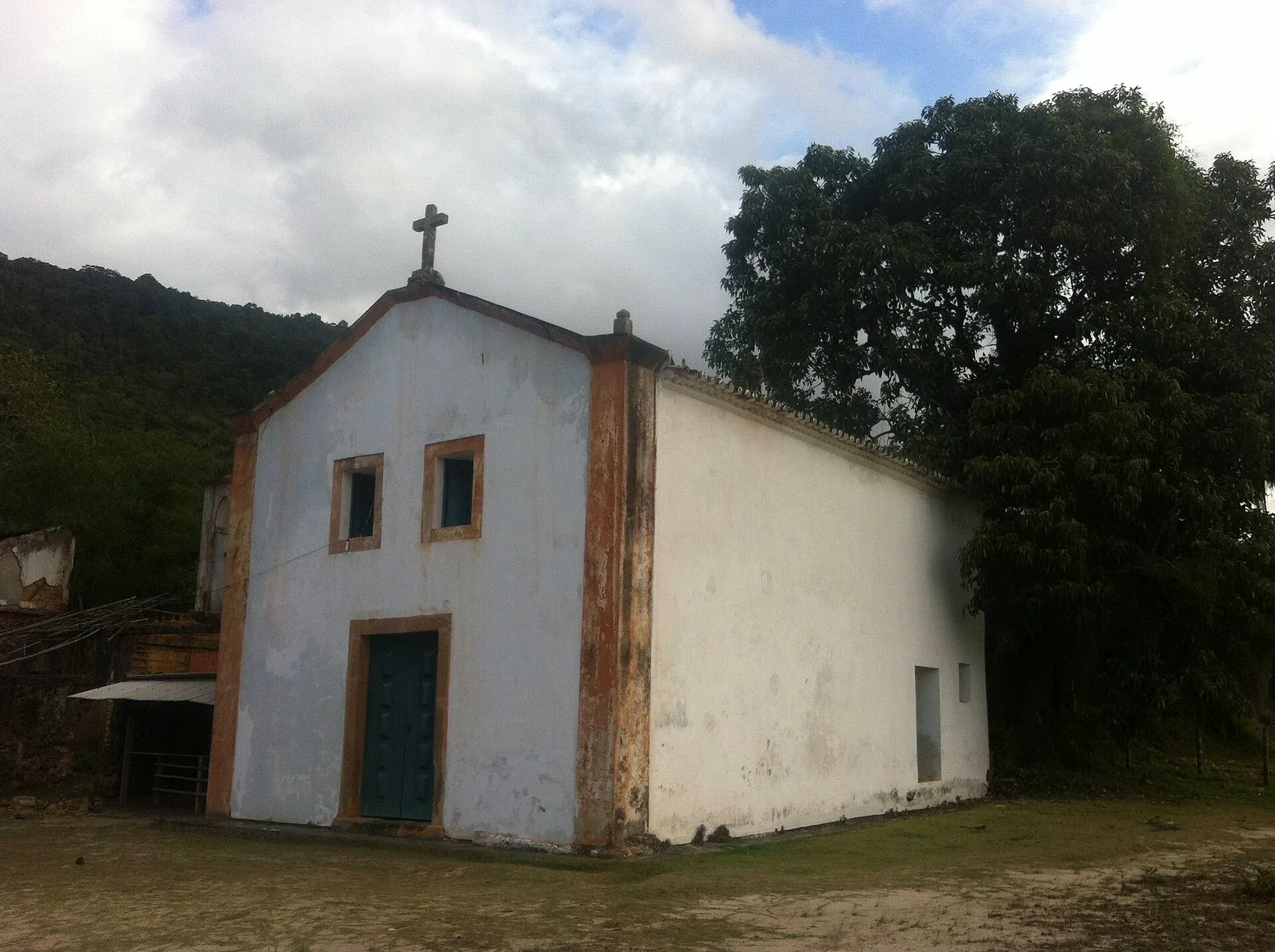
Everything starts at Paraty-Mirim. There is no road into Saco do Mamanguá itself — the only ways in are by water or on your own two feet. That is a feature, not a nuisance, but it does mean a little planning.
Driving or the bus to Paraty-Mirim
By car it is a straightforward half-hour from town, with the last few kilometres on unpaved road that is fine for an ordinary vehicle in dry weather and slower after heavy rain. There is a rough parking area near the beach where local families keep an eye on cars for a small fee. If you would rather not drive, the local Colitur bus runs from Paraty's bus station out to Paraty-Mirim several times a day; it is cheap and reliable but slow, so check the return times before you commit, because the last bus back is earlier than you would like. For the full rundown of buses, taxis and drivers, see our guide to getting around.
The boat crossing
At Paraty-Mirim beach you will find boatmen offering the crossing into the inlet. Two kinds of boat work this route. The fast fibreglass taxi-boats get you to the main beaches in around twenty minutes; the traditional wooden boats take closer to forty, but the slower ride is arguably the nicer one, low and quiet over green water. Prices are per boat or per person depending on the operator and the season, always negotiated on the beach, and always in cash. Agree the route, the beaches you want and the pickup time before you step aboard, and take a photo of the boat and the boatman's name so there is no confusion about who is collecting you.
You can also charter a schooner or a private launch straight from Paraty's main pier and skip the drive entirely, which is the easy, comfortable option if you are a group or simply want the day handled. A number of the operators who run standard bay tours will divert to Mamanguá on request. We arrange this kind of thing for guests all the time; more on how we do it in our boat days guide, and if you want us to line one up, just get in touch.
Cash and timing. There are no card machines, ATMs or shops inside Saco do Mamanguá. Bring more small notes than you think you need — for the boat, lunch, a handicraft, a guide — and settle your return pickup time firmly before you leave the beach. Phone signal is patchy to non-existent in the inlet.
Walking in
Fit walkers can reach Mamanguá on foot along the coastal trail that starts near Paraty-Mirim. The shorter approach to the inner beaches is around ninety minutes of undulating forest path; the full peninsula traverse is a serious all-day expedition of eight hours or more that most people should only attempt with a guide. If you like the idea of arriving under your own steam, our hiking around Paraty guide covers the trailheads and what the paths are really like underfoot.
Kayaking Saco do Mamanguá
If there is one activity the inlet was made for, it is sea kayaking. National Geographic Traveler once described this stretch of coast as a sea-kayaker's dream, and the description has stuck for good reason. The water inside the inlet is protected and usually glass-calm, the distances are human-scaled, and the shoreline unrolls a steady sequence of beaches, mangrove channels and communities to aim for. You are never far from land, which takes the anxiety out of it for beginners while still giving strong paddlers a proper day's work if they want the length of the whole inlet.
A kayak is also, quietly, the right tool for the place. It is silent, it draws almost no water, and it lets you slip into the shallow mangrove where motorboats cannot and should not go. You will hear more, see more birds, and leave less behind.
A word on conditions, because they matter more than fitness here. The inlet is at its calmest in the early morning, before the day's breeze fills in from the mouth. By early afternoon a light chop can build on the outer third nearest the open bay, and in summer the rain tends to arrive around then as well. None of it is dangerous in a guided group hugging the shore, but it is the difference between an easy glide and a slog, which is why every experienced guide launches early and turns for home before the wind gets up. Plan your day around that and the paddling stays a pleasure rather than a workout.
The half-day paddle
The most popular option is a guided half-day: two hours or so of paddling that typically takes in a crossing of the inlet, a nose into the mangrove, and a stop at a beach for a swim before turning back. It is well within reach of anyone reasonably active, children included with a guide and a stable double kayak, and it is the version we suggest for most first-timers. Go in the morning when the water is at its stillest and the light comes in low over the ridges.
The multi-day expedition
For paddlers who want the full experience, specialist operators run two- and three-day kayaking trips that work down the length of the inlet, camping on beaches or staying simply with caiçara families, cooking the catch of the day and climbing the peak along the way. These are properly memorable and genuinely sustainable trips, run by outfitters who know the families and the tides. They need booking ahead and a baseline of fitness, but no prior kayaking experience. If a slow, low-impact, few-days-off-the-grid trip appeals, this is one of the best on the Brazilian coast.
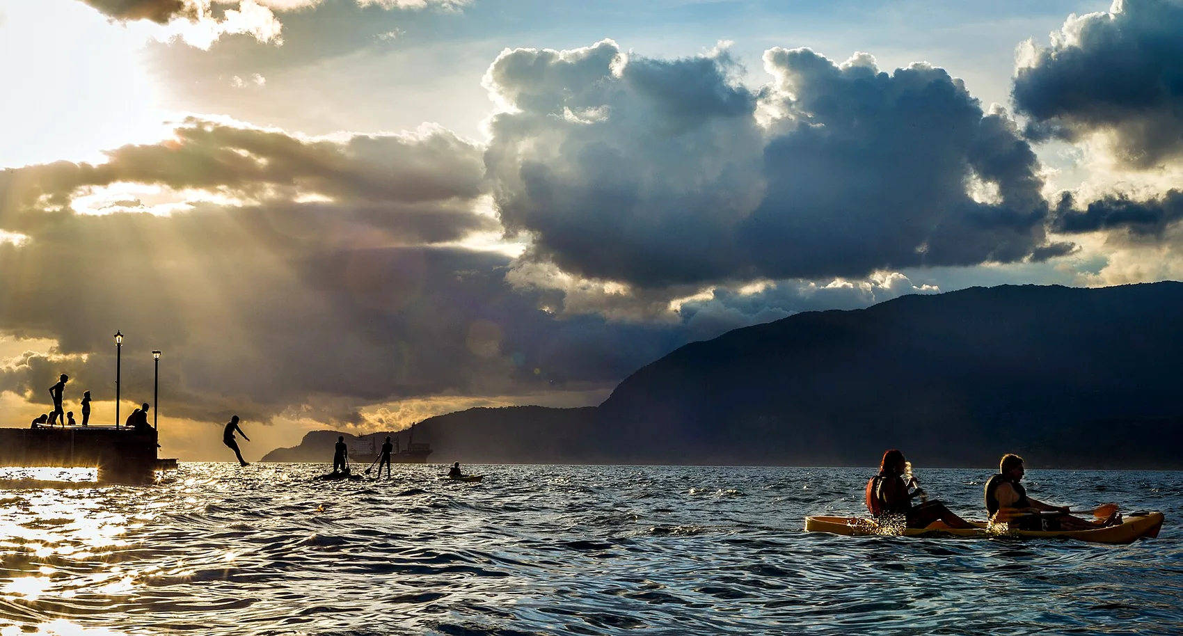
Stand-up paddleboards work too, on a calm morning, and some operators offer them as an alternative to kayaks. They are a lovely way to drift the flat water near the head of the inlet, though a kayak is the safer bet if there is any breeze or if you want to cover real distance.
The Pico do Mamanguá climb
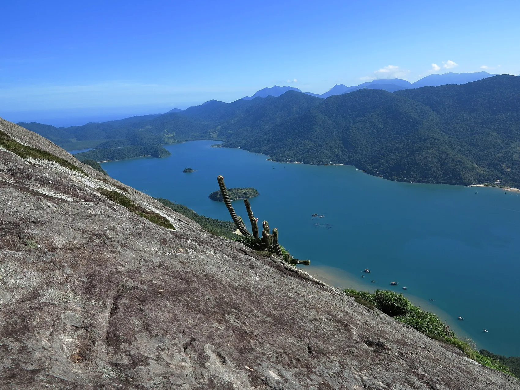
Rising straight out of the inner shore is the Pico do Mamanguá, the peak that gives the inlet its most famous view. It is often called the Pico do Pão de Açúcar — the local Sugarloaf — and there is a friendly bit of one-upmanship in that, because at around 425 metres it stands taller than Rio's celebrated Sugarloaf. From the top you look straight down the full length of the green inlet on one side and out across the open bay on the other, and on a clear day it is one of the great views of this whole coast.
You climb for two sweaty hours through the forest and then the trees stop, and the entire inlet is laid out below you like a river of green glass.
The trail
The climb starts from near the head of the inlet, so almost everyone reaches the trailhead by boat as part of a Mamanguá day. From there it is a steep, mostly shaded forest path that gains its height quickly. Most walkers take somewhere between ninety minutes and two hours to the summit, with a short scramble over rock near the top where you will use your hands. It is graded moderate to hard: there is nothing technical about it, but it is relentlessly uphill and it is hot, so it defeats plenty of people who underestimate it.
What you will need
Shoes with real grip, not flip-flops. At least a litre and a half of water per person. An early start — first light is ideal — to climb in the cool and beat the cloud that often builds over the peak by midday. A hat and sunscreen for the exposed summit. And, honestly, a guide if you are not a confident hiker, because the path is not always obvious and the scramble at the top is not the place to be second-guessing the route. A local guide costs little and adds a great deal, both in safety and in what they will tell you about the forest.
Is it for you?
If you walk regularly and do not mind sweating, yes — the reward is out of all proportion to the effort. If you have young children, dodgy knees or a fear of exposed scrambling, be honest with yourself; the view from the water is glorious in its own right, and there is no shame in skipping the summit for a longer swim. Families weighing this up will find our Paraty with kids guide useful for calibrating what everyone will actually enjoy.
The caiçara communities
Saco do Mamanguá is not wilderness, and understanding that is part of visiting it respectfully. Scattered around its shores are several caiçara communities — the traditional coastal people of this part of Brazil, descended from Indigenous, Portuguese and African roots, who have fished, farmed small plots of cassava and lived by the tides here for generations. A few hundred people live in these settlements, reachable only by boat or trail, in a rhythm that the road and the modern town never fully reached.
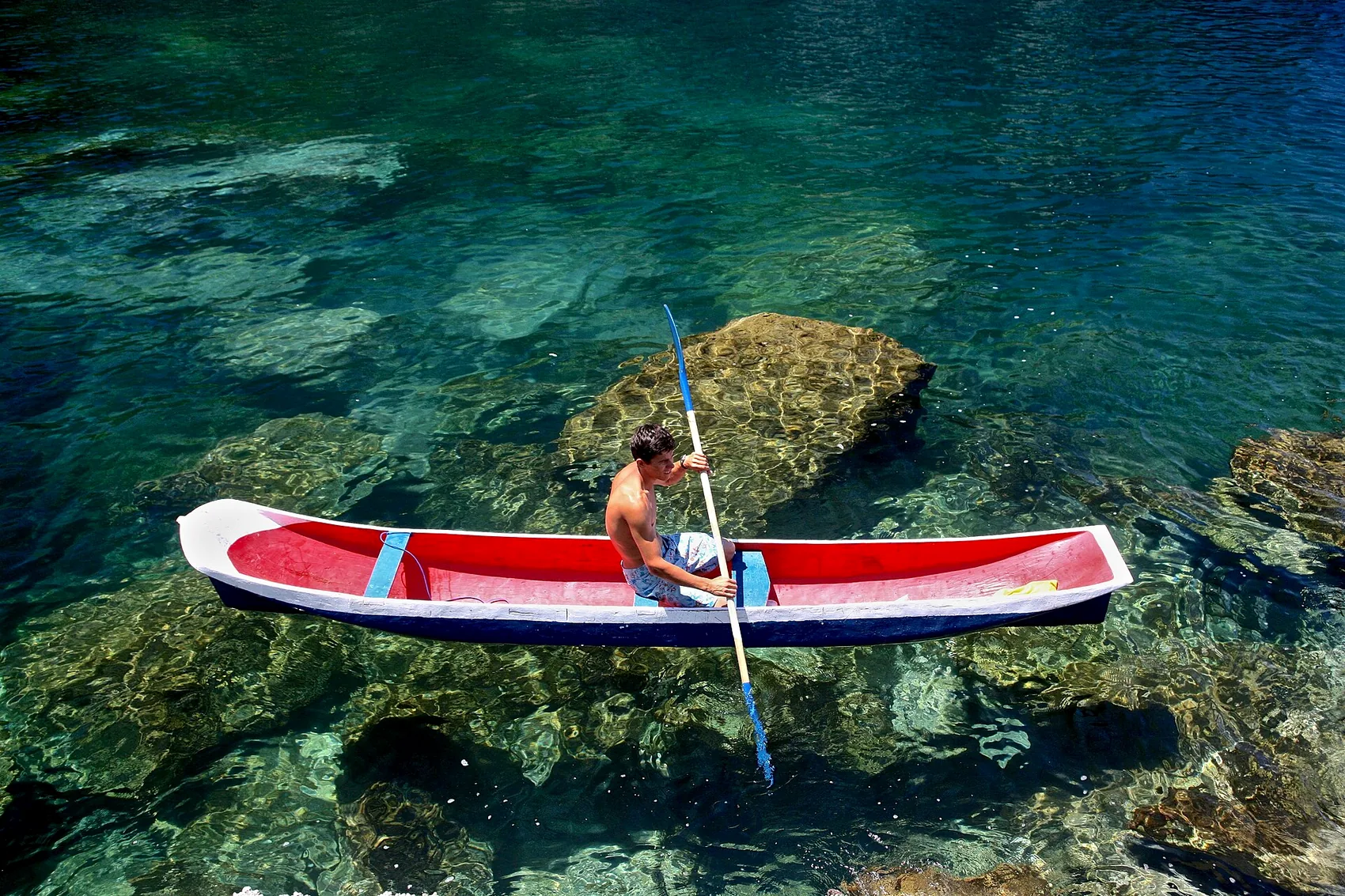
For visitors this shows up in the best possible ways. Some families run simple beach kitchens where lunch is whatever came in on the boat that morning, grilled or turned into a moqueca and served under a tree. Others carve canoes and decorative boats from single logs, or make handicrafts you can buy directly from the maker. A few guide walks, rent kayaks or offer a hammock and a plate of food for the night. Spending your money with them, rather than only with operators from town, is the single most useful thing a traveller can do here.
The etiquette is common sense. These beaches are people's front gardens, so ask before photographing anyone, keep noise down, and do not treat a family's home as a film set. Buy the lunch, buy the carving, pay the guide fairly and in cash. The communities have lived through real pressure over land and access, and they carry on partly because visitors value what they do. Our note on sustainable travel on the Costa Verde goes deeper on how to get this right across the whole region.
It is worth understanding, briefly, why this culture is worth your respect rather than just your curiosity. Caiçara life is built on a deep, practical knowledge of the sea and the forest — which fish run when, which tides let a canoe cross a bar, which plants heal and which feed. That knowledge is exactly what keeps a place like Mamanguá intact, because people who depend on a living inlet have every reason to protect it. When you eat a fish someone caught that morning and pay a fair price for it, you are not being charitable; you are taking part in the system that keeps the water clean and the forest standing. That is a better souvenir than anything with a price tag.
The mangrove and the wildlife
At the shallow, muddy head of the inlet is one of the best-preserved mangroves in Ilha Grande Bay, and it is the ecological heart of the whole place. Mangrove is not scenery in the postcard sense — it is a low tangle of salt-tolerant trees standing on stilted roots in brackish water — but it is astonishingly alive. It is the nursery of the bay, where fish spawn and juvenile creatures shelter among the roots, and it is the reason the fishing around Mamanguá has stayed good.
Slip into it quietly by kayak and you will see crabs working the mud, herons and kingfishers stalking the shallows, and, if you are lucky and still, oysters clustered on the roots. The bird life is excellent throughout the inlet — this is Atlantic Forest coast, and toucans, hummingbirds and a long list of species live in the hills above the water. Out in the deeper channels people occasionally report sea turtles, and, rarely, dolphins nosing in from the bay. None of this is guaranteed on any given day, which is exactly how wild places should be.
The one firm rule is to tread lightly. Mangrove is fragile and slow to recover. Do not snap the roots, do not leave anything behind, and use reef-safe sunscreen so you are not shedding chemicals into the nursery. If natural history is a big part of why you travel, our guide to snorkelling and diving the Costa Verde covers the underwater side of the same coast.
Leave no trace. There is no rubbish collection inside Saco do Mamanguá — everything you carry in, you carry out. Skip single-use plastic where you can, keep to the water and the marked beaches, and give the mangrove roots a wide berth. The inlet stays this good because most visitors treat it well.
The beaches inside the inlet
Strung along the eight kilometres of shoreline are dozens of small beaches, most of them a scoop of sand between forest and calm water, several with a caiçara family and a beach kitchen, a few completely empty. Because the inlet is sheltered, the water at these beaches is flat and warm — ideal for a long, unhurried swim and for children who find open-sea surf intimidating.
We will not hand you a numbered list of "must-visit" beaches, partly because the right one depends on the day, the tide and where your boatman is heading, and partly because the pleasure here is in letting the boatman or your guide read the conditions and pick. Tell them what you want — a lunch beach with food, an empty cove for a picnic, the trailhead for the peak — and they will route you accordingly. What you can count on is that the beaches deepen in character as you go further in: busier and easier near the mouth, wilder and quieter toward the head.
If pure emptiness is what you are chasing, note that some of the region's most storied remote beaches — Praia do Sono and the coves beyond it — sit on the same Juatinga peninsula, reached from a different trailhead. They are a separate outing rather than part of a Mamanguá day, but they belong to the same wild corner of the map, and they show up in our wider beach coverage.
How it compares to the bay tour
Most first-time visitors to Paraty do the classic schooner tour of the outer bay — the one that hops between island snorkelling stops with a caipirinha on deck — and it is a fine day out. But Mamanguá is a different animal, and it helps to know which you are choosing. The bay tour is social, easy and busy, with music and a crowd and a set route between well-known islands. Mamanguá is quieter, wilder and more physical: less deck-lounging, more paddling and walking and talking to the people who live there. If you have time for both, do both. If you have to pick one and you lean toward nature over party, choose the inlet. Our boat days guide compares the range of water trips on offer so you can match the day to your group.
When to go
Mamanguá is a year-round destination, but the season shapes the day. The Brazilian summer, from December to March, brings the warmest water, the longest days and the greenest forest — and also the heaviest afternoon downpours and the biggest crowds around New Year and Carnival. The shoulder months either side, roughly April to June and September to November, are our favourite: warm enough to swim, calmer weather, fewer boats, and the forest still lush. The cooler, drier winter from June to August is quieter still and excellent for the climb, though the sea is bracing rather than balmy.
Whatever the month, mornings are the prize. The water is stillest early, the light is best, the peak is clearest before the cloud builds, and you are off the water before the afternoon rain that this coast delivers with some reliability in summer. For a proper month-by-month breakdown, see the best time to visit Paraty, and check the calendar too, because a big event in town like the FLIP literary festival or the Festa do Divino changes the rhythm of the whole area — our guide to Paraty festivals and events lays out the dates.
What to bring
Pack light but pack right, because there is nothing to buy once you are in the inlet. The essentials: plenty of water, sun protection and a hat, reef-safe sunscreen for the mangrove, a dry bag for phone and camera, a hat and grippy shoes if you plan to climb, a swimsuit and a quick-dry towel, insect repellent for the shaded stretches, and cash in small notes for the boat, lunch and any handicraft you cannot resist. A light long-sleeved top saves you from the summit sun and the midday glare on the water.
Leave behind anything you would mind getting wet or sandy, and anything single-use you would have to carry back out. Our full Paraty packing guide covers the wider trip, but for a Mamanguá day the short version is: sun, water, cash, dry bag, good shoes.
One thing people forget is a small first-aid basics kit — a few plasters, painkillers, antihistamine — because there is no pharmacy anywhere near the inlet and the nearest help is back in Paraty-Mirim at best. It rarely gets used, but on the day you scrape a shin on the summit scramble or react to a bite, you will be glad it is in the dry bag. Keep it light; you are carrying everything yourself.
How a Mamanguá day fits a stay on the hillside
Here is how the day tends to unspool for our guests, and why the inlet and the chalé suit each other. You leave the house early, while the valley is still cool, and drive down and along to Paraty-Mirim. You are on the water by mid-morning, when the inlet is at its calmest — a paddle into the mangrove, a swim off an empty beach, lunch of the morning's catch under a tree, and, for those with the legs for it, the sweaty climb up the Pico for that long green view. By mid-afternoon, sun-tired and salt-crusted, you point the boat back out.
And then the good part. Twenty-odd minutes later you are back up the hill, and the infinity pool is waiting at the edge of the deck with the whole triple view — the Bay of Paraty, Angra dos Reis and Ilha Grande — laid out in the low light. You rinse the salt off, you pour something cold, and you watch the day end over the same water you spent it on. A wild inlet by day and a still pool by evening is a very good pairing, and the short drive between them is what makes it work.
That balance — genuine adventure within easy reach of somewhere calm to come back to — is the whole idea of a stay here. If a slow long weekend built around exactly this kind of day appeals, our luxury long weekend in Paraty guide sketches the shape of it, and you can always explore the rest of what the area offers before you commit to a plan.
Practical answers before you go
A few last honest notes. Signal in the inlet is poor, so download anything you need and tell someone your rough plan before you lose contact. The dirt road to Paraty-Mirim can get rutted after rain; nothing an ordinary car cannot handle carefully, but allow extra time. Boat prices are always negotiated on the beach and vary with the season, so ask a couple of boatmen and agree everything — route, beaches, pickup time — up front. And if you are prone to seasickness, the good news is that the water inside the inlet is calm; the only lumpy bit is the short open crossing from Paraty-Mirim, and a tablet beforehand handles that.
For travellers coming from São Paulo, the drive is roughly four to five hours down the coast road; from Rio it is a little shorter, around four. Either way Mamanguá is the kind of place that justifies the trip on its own — a half-day's drive from a major city delivers you to a coast that feels a world away from both. Break the journey in Paraty, sleep on the hillside, and do the inlet fresh the next morning rather than tired off the road. For those flying in from abroad, it is worth understanding that the remoteness is the point: no resort, no beach club, no wifi in the mangrove, just water, forest and the families who live by them. Come for that, not despite it, and you will not be disappointed.
If you would like us to help you build a day around the inlet — line up a boat, point you at the right guide for the climb, or simply tell you whether tomorrow's weather suits it — that is exactly the sort of thing we are here for. Have a look through our other quiet-beaches guide, browse the journal for more of the area, and write to us whenever you are ready. Saco do Mamanguá is one of the trips we most enjoy sending people on, and it is a short drive from a pool with a very good view.
Come stay above the bay
Chalé Bel Air sits on the ridge that looks over everything in this guide. Tell us your dates and what kind of trip you are after — we answer personally.
Ask about your datesFrequently asked questions
What is Saco do Mamanguá and why is it called a tropical fjord?
It is a long, narrow inlet of the sea that pushes about eight kilometres inland between two forested mountain ridges on the Juatinga peninsula, south of Paraty. People call it a fjord because of that steep-walled, deep-into-the-land shape. Strictly speaking it is a ria — a drowned river valley — rather than a glacier-carved fjord, but the resemblance is why it earned the nickname.
How do you get to Saco do Mamanguá from Paraty?
You drive about eighteen kilometres south to the village of Paraty-Mirim — roughly thirty minutes by car, a little longer on the local Colitur bus. From the beach there you take a boat into the inlet, which runs anywhere from about twenty minutes by fast taxi-boat to forty minutes in a traditional wooden boat. Fit walkers can also hike in on the coastal trail.
How hard is the Pico do Mamanguá hike?
It is short but steep. The peak stands about 425 metres above the water, and the climb from the trailhead near the head of the inlet takes most people around ninety minutes to two hours up, with a scramble near the top. It is graded moderate-to-hard: no technical climbing, but you need a decent level of fitness, grippy shoes and an early start to beat the heat.
Can you kayak in Saco do Mamanguá?
Yes, and it is one of the best sea-kayaking spots in Brazil. The water inside the inlet is sheltered and usually calm, which suits beginners, while the length of it and the mangrove channels give stronger paddlers plenty to explore. You can do a half-day guided paddle or a two-to-three-day camping trip that links beaches and communities along the shore.
Do people live in Saco do Mamanguá?
Yes. Several small caiçara communities — the traditional fishing culture of this coast — live around the inlet, a few hundred people in total, in settlements reachable only by boat or trail. Some families run simple beach kitchens, sell handicrafts and carved canoes, or guide visitors. Treat their beaches and homes as the lived-in places they are, not a backdrop.
Is Saco do Mamanguá worth it as a day trip?
For most guests, yes. A single day is enough to get on the water, see the mangrove, have a seafood lunch on a beach and, if you start early, climb the peak. If you want to paddle the whole inlet or camp among the communities, give it two or three days. Either way it pairs naturally with a base near Paraty.
What should I bring to Saco do Mamanguá?
Sun protection, water, cash in small notes (there are no card machines on the beaches), reef-safe sunscreen for the mangrove, sturdy shoes if you plan to climb, and a dry bag for phones and cameras. There are no shops or pharmacies inside the inlet, so pack what you need and carry your rubbish back out.